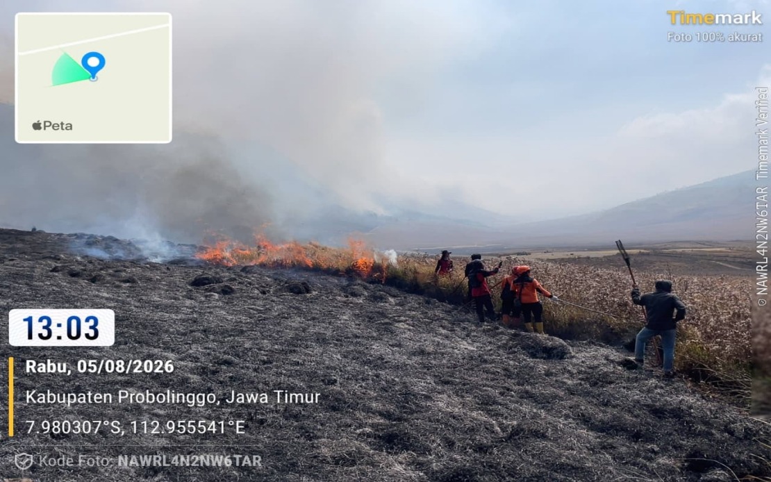
Indonesia's National Disaster Management Agency has mobilised aerial firefighting resources to tackle an escalating wildfire at Mount Bromo in East Java, with the blaze now ravaging around 60 hectares of forest and grassland across two regencies. The emergency escalation highlights the challenges posed by fires in mountainous terrain, where difficult geography often outpaces the capacity of ground teams to respond effectively.
The fire ignited on Monday and has since consumed approximately 10 hectares within Probolinggo Regency while engulfing a substantially larger area—some 50 hectares—in the Bromo Tengger Semeru National Park situated in neighbouring Malang Regency. According to Abdul Muhari, head of the National Disaster Management Agency's Disaster Data, Information and Communication Centre, the scale and location of the fire presented significant operational challenges that prompted authorities to pivot toward aerial intervention.
By Wednesday afternoon, ground teams had achieved meaningful progress in containing the majority of the fire's active front. However, this apparent progress masked a persistent threat: numerous hotspots remained stubbornly active in steep, virtually inaccessible areas where conventional firefighting methods proved ineffective. These remnant fires, scattered across precipitous slopes, presented precisely the type of challenge that justified the helicopter deployment announced on Thursday.
The two water-bombing helicopters now operating over Mount Bromo represent a critical asset in reaching locations where terrain and gradient prevent ground personnel from operating safely or effectively. The deployment underscores how Indonesia's disaster management framework increasingly relies on integrated responses combining ground operations with aerial support, particularly in protected natural areas where both environmental sensitivity and topographical difficulty demand sophisticated tactical approaches.
Beyond immediate aerial operations, the National Disaster Management Agency has initiated preparatory steps for a Weather Modification Operation—a technique that harnesses atmospheric conditions to trigger precipitation over affected areas. Such operations remain contingent on meteorological conditions proving favourable, and their deployment would complement rather than replace the ongoing helicopter water-bombing and ground firefighting efforts. This multi-layered response strategy reflects lessons learned from previous major fire events across the Indonesian archipelago.
The Bromo Tengger Semeru National Park Authority has implemented a precautionary closure affecting accessible portions of the Mount Bromo tourist zone, a necessary measure that simultaneously protects visitors from smoke and hazardous conditions whilst clearing airspace and ground areas for emergency operations. The temporary closure carries economic implications for local tourism operators and communities dependent on visitor traffic, though authorities frame the restriction as essential for both public safety and firefighting effectiveness.
Investigations into the fire's origin have tentatively identified a campfire abandoned by hikers as the probable cause, suggesting that recreational activities contributed to what became a significant environmental emergency. This finding reinforces the tension between Mount Bromo's status as a major tourist destination and the fire risks inherent in popular hiking areas, particularly during dry seasons when vegetation moisture content drops significantly. The preliminary findings underscore ongoing challenges in balancing tourism development with environmental management in Indonesia's national parks.
For Malaysian observers, the Mount Bromo incident offers instructive parallels to domestic forest fire challenges, particularly in peninsular regions where similar topography and vegetation patterns create comparable risks. The Indonesian response—combining helicopter assets, weather modification contingencies, and multi-agency coordination—mirrors frameworks increasingly adopted across Southeast Asia as nations confront intensifying and more frequent wildfire events linked to climate variability and land-use pressures.
The incident also reflects broader vulnerabilities across the region's protected areas, where tourism infrastructure and recreational access can inadvertently increase fire ignition risks. As Mount Bromo attracts thousands of visitors annually, managing the tension between accessibility and fire prevention requires sophisticated land management approaches, visitor education initiatives, and season-responsive operational policies—considerations equally relevant to Malaysian national parks facing similar pressures.
The deployment of advanced firefighting capabilities to Mount Bromo demonstrates how Southeast Asian nations are progressively investing in aerial fire management infrastructure and sophisticated emergency response systems. Yet the underlying challenge—managing fire risk across vast protected territories with diverse terrain—remains fundamentally difficult and resource-intensive, suggesting that prevention and visitor education may ultimately prove as critical as emergency response capabilities in reducing future incidents.