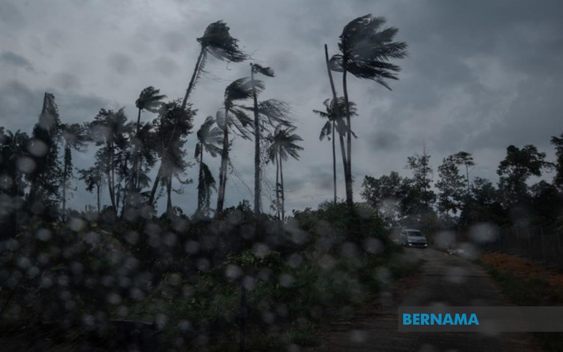
The Malaysian Meteorological Department has alerted the public to prepare for severe weather conditions spanning much of the country, with thunderstorms, heavy rain and strong winds expected to persist until 6 pm today across multiple districts in Peninsular Malaysia, Sabah and Sarawak. The nationwide warning underscores the importance of residents taking precautions and remaining vigilant during the afternoon hours, particularly in low-lying areas prone to flash flooding and communities near weather-exposed terrain.
In the northern regions, the warning encompasses Langkawi in Kedah and a substantial portion of Perak, where six districts face potential weather disruptions. The affected areas in Perak include Kinta, Perak Tengah, Kampar, Hilir Perak, Batang Padang and Muallim, suggesting that the thunderstorm system is affecting both the coastal and inland zones of the state. Given Perak's geographical positioning along major transportation corridors, disruptions in these districts could impact regional connectivity and commerce during the evening period.
The East Coast states have been particularly flagged in the meteorological warning, with Kelantan experiencing nine districts under alert. Tumpat, Pasir Mas, Kota Bharu, Jeli, Tanah Merah, Bachok, Machang, Pasir Puteh and Kuala Krai all face the prospect of intense rainfall and electrical storms. This broad coverage suggests an organized weather system sweeping across the state, which is notable given Kelantan's vulnerability to flooding during monsoon periods. Similarly, Terengganu residents in Besut, Setiu, Kuala Nerus and Kemaman have been advised to prepare for adverse conditions.
Pahang, Malaysia's largest state by land area, has nine districts included in the warning, spanning from the highlands through to the lowlands and coastal regions. Cameron Highlands, Lipis, Raub and Bentong represent the elevated interior zones where heavy rain could trigger landslides and disrupt hill station operations, while Temerloh, Kuantan, Bera, Pekan and Rompin encompass the state's more populated and economically significant districts. The inclusion of Cameron Highlands is particularly significant, as the highland district is a major agricultural and tourism hub that can be severely impacted by intense rainfall.
In Selangor, Malaysia's most densely populated state, only Hulu Selangor and Gombak have been placed under the thunderstorm alert. Despite the limited geographic coverage compared to other states, these districts contain substantial residential populations and form part of the greater Klang Valley metropolitan region, making any disruption consequential for the nation's economic core. The warning for these areas reflects the unpredictable nature of localized thunderstorm cells that can develop rapidly across specific zones.
Negeri Sembilan's exposure is limited to two districts—Jempol and Tampin—though both are centrally located within the state. In Johor, the warning extends across five districts: Tangkak, Segamat, Kluang, Mersing and Kota Tinggi. The inclusion of Mersing and Kota Tinggi, both coastal districts, alongside the inland areas suggests the weather system has considerable geographic reach, potentially affecting both maritime activities and overland transport routes in the southern region.
Sabah's warning coverage is notably extensive, reflecting the state's susceptibility to sudden weather changes during the Southwest Monsoon period. Five interior districts—Sipitang, Tenom, Beaufort, Keningau and Tambunan—face the alert, while the west coast region includes Papar, Putatan, Penampang, Kota Kinabalu and Tuaran. The coverage of Kota Kinabalu, Sabah's capital and largest city, indicates that significant urban disruption is possible. Additionally, Lahad Datu in the Tawau division and Kinabatangan in the Sandakan division have been included, demonstrating that the meteorological system affects both the peninsula and the eastern Malaysian states with comparable intensity.
In Sarawak, the affected areas comprise Tatau and Sebauh in Bintulu, Subis in Miri and Limbang. These districts span the state's different regions, with Limbang representing the northernmost portion and Tatau-Sebauh reflecting the central coastal zone. The warning distribution suggests the weather disturbance is sufficiently developed to affect wide geographic areas across Sarawak simultaneously.
The timing of this warning is significant, as afternoon thunderstorms can rapidly escalate into hazardous conditions, particularly for outdoor activities, construction sites and traffic operations. Residents are typically advised to seek shelter when thunder is audible, avoid standing water that may conceal debris or dangers, and exercise caution on flooded roads that can become impassable within minutes. The six-hour window until 6 pm represents the peak danger period, after which conditions are expected to gradually improve.
For Malaysian readers and regional observers, such widespread meteorological alerts reflect the complexity of Malaysia's equatorial and tropical climate, where multiple weather systems can simultaneously affect vast areas. The timing of this particular warning during the Southwest Monsoon period is consistent with seasonal patterns, though the specific intensity and coverage warrant close monitoring from relevant authorities. Organizations operating across the affected districts should have contingency protocols in place for weather-related disruptions affecting employees, supply chains and service delivery.
The comprehensive nature of this alert demonstrates MetMalaysia's commitment to providing advance warning of potentially dangerous weather conditions. Residents in the listed districts are encouraged to monitor official meteorological updates, particularly as the 6 pm deadline approaches, to determine whether the warning extends beyond the initial timeframe or whether conditions improve as projected. Preparation measures, including securing loose outdoor objects and avoiding unnecessary travel through areas prone to flash flooding, remain prudent precautions during the alert period.