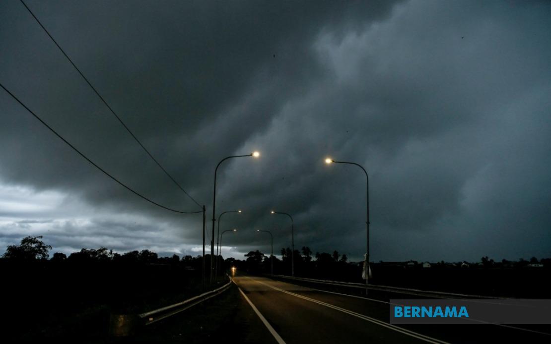
The Malaysian Meteorological Department (MetMalaysia) has activated weather alerts across a broad swathe of the country, warning residents and commuters to prepare for dangerous atmospheric conditions throughout the day. Thunderstorms, torrential rainfall and gusty winds are forecast to strike numerous districts in Peninsular Malaysia as well as the eastern Malaysian states until 5 pm, prompting authorities to advise caution during travel and outdoor activities.
On the peninsula's northern tier, residents in Perlis face the full brunt of the incoming weather system. In Kedah, the districts of Langkawi, Kubang Pasu, Kota Setar, Pokok Sena, and Padang Terap are all positioned in the warning zone. The west coast state of Perak, particularly the divisions of Manjung, Perak Tengah, and Hilir Perak, should expect hazardous conditions. Moving east, Pahang's higher elevation zones including the popular hill station of Cameron Highlands, as well as Raub, Bentong, and Rompin, fall within the affected regions.
The densely populated federal territories of Kuala Lumpur and Putrajaya are included in the alert, potentially disrupting rush-hour traffic and urban activities. Melaka's relatively compact geography means the entire state lies under the warning umbrella. Selangor, the nation's economic powerhouse and most populous state, faces significant exposure with eight districts flagged: Kuala Selangor, Hulu Selangor, Klang, Gombak, Petaling, Kuala Langat, Hulu Langat and Sepang. This coverage essentially blankets the Klang Valley metropolitan region and surrounding areas, raising concerns about flooding in low-lying residential and commercial zones.
Negeri Sembilan's warning encompasses six divisions across the state: Jelebu, Seremban, Port Dickson, Kuala Pilah, Rembau and Tampin, suggesting the system will sweep the entire state from northern highlands to coastal plains. In Johor, the southern peninsula's largest state, three divisions have been targeted for alerts—Tangkak, Segamat and Muar—indicating the storm's southern penetration into the nation's manufacturing and agricultural heartland.
Beyond Peninsular Malaysia, Sarawak's major urban and commercial centers face similar threats. Kuching, the state capital and economic center, along with nearby Samarahan, will experience the severe weather. The warnings extend to Mukah division, specifically the towns of Matu, Dalat, and Mukah, and to Kapit division's Song area, reaching into the interior regions. The northern coastal zone of Miri, encompassing Subis, Telang Usan, and Miri itself, rounds out Sarawak's exposure.
Sabah's alert is more geographically focused but still significant. The Interior division's Kuala Penyu area and the southeastern Tawau district, including the twin towns of Tawau and Semporna, fall within the warning parameters. These locations along Sabah's coasts and near the Sulu and Celebes seas are particularly vulnerable to heavy precipitation and strong winds, which can generate dangerous sea conditions.
The concentration of warnings across such extensive territory underscores the scale and intensity of the incoming weather system. This is not a localized thunderstorm but rather a widespread atmospheric disturbance affecting every major population center and economic zone across the country. The geographic spread—from the northern borders with Thailand down through the peninsula's spine and across to the island states—indicates a significant low-pressure system or monsoon trough influencing Malaysian airspace.
For commuters and businesses, the 5 pm deadline carries practical importance. The afternoon timeframe overlaps with peak traffic hours in urban centers, potentially creating hazardous driving conditions precisely when roads are most congested. Schools, offices, and shopping centers must weigh weather risks against operational schedules. Construction sites and outdoor events will require contingency planning or postponement.
The meteorological warning system, while providing essential advance notice, depends on public awareness and preparedness. Residents in the flagged areas are advised to secure outdoor items, avoid unnecessary travel, and monitor weather updates from official channels. Drivers should exercise heightened caution, particularly on highways prone to hydroplaning during heavy downpours. Drainage systems in urban areas may become overwhelmed if rainfall intensity exceeds infrastructure capacity, creating flash flooding risks in historically vulnerable zones.
For Malaysia's agricultural sector, particularly in Peninsular Malaysia's highland farming regions and Sabah's rubber and palm oil estates, the heavy rainfall poses both opportunities and challenges. While moisture is essential for crop growth, excessive rainfall accompanied by strong winds can damage plants and disrupt harvesting operations. Farmers in affected districts may need to implement protective measures or defer field work until conditions stabilize.
The maritime sector faces its own considerations, with strong winds and rough seas potentially affecting fishing operations and coastal transportation. Port authorities in Klang, Port Dickson, and other maritime hubs may need to adjust schedules or impose restrictions on vessel movements depending on wind speeds and wave heights.
MetMalaysia's proactive approach to weather warnings reflects the nation's vulnerability to rapid atmospheric changes and the potential for severe consequences when residents are caught unprepared. As climate patterns continue to show variability and intensity variations, such alerts serve as critical public safety mechanisms, enabling individuals and institutions to take protective action before dangerous conditions materialize.